The Wildfire Crisis and the Need for Proactive Defense
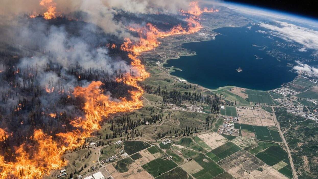
Wildfires are no longer seasonal anomalies—they are a global crisis. Driven by climate change, prolonged droughts, and expanding human encroachment into wildlands, wildfires now burn hotter, spread faster, and threaten more lives and property than ever before. Traditional wildfire management relies on reactive strategies: fighting fires once they ignite, often with limited success. But as the frequency and intensity of fires rise, the need for predictive prevention—anticipating where and when fires will start—has never been greater.
Enter AI-powered satellite imagery analysis: a revolutionary approach that leverages artificial intelligence (AI) to process vast amounts of satellite data, identify patterns, and predict wildfire risks with unprecedented accuracy. By merging cutting-edge machine learning with high-resolution satellite imagery, this technology is transforming wildfire prevention from a game of catch-up to a proactive, data-driven science. This article explores how AI and satellite imagery are reshaping wildfire prevention, the mechanics of their collaboration, and the challenges and opportunities they present.
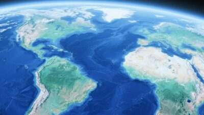
Satellite Imagery: The Eyes in the Sky for Wildfire Detection
Satellites have long been critical tools for monitoring Earth’s surface, and their role in wildfire management is no exception. Orbiting the planet, satellites capture high-resolution images across multiple spectrums—visible, infrared, thermal, and radar—providing a wealth of data that human eyes alone cannot process. Key types of satellite data used in wildfire prediction include:
- Optical Imagery: Captures visible light, revealing vegetation health, burn scars, and human activities (e.g., campfires, power lines) that spark fires.
- Thermal and Infrared Data: Detects heat signatures, identifying “hot spots” where temperatures exceed normal levels—an early indicator of ignition.
- Radar and Microwave Data: Penetrates clouds and smoke, mapping terrain and vegetation density to assess fuel availability for fires.
For example, NASA’s Moderate Resolution Imaging Spectroradiometer (MODIS) and the Landsat series provide daily global coverage, while the Sentinel satellites (operated by the European Space Agency) offer higher-resolution data. These satellites generate terabytes of imagery daily, creating a “fire alarm system” that never sleeps.
AI: The Brain Behind the Prediction
While satellites collect the data, AI acts as the analytical engine, transforming raw imagery into actionable insights. Machine learning (ML) models, particularly deep learning (DL) architectures, are trained to recognize patterns in satellite data that correlate with wildfire ignition and spread. Here’s how the process works:
1. Data Preprocessing: Cleaning and Enhancing Imagery
Satellite data is often noisy—clouds, shadows, or sensor errors can obscure critical details. AI algorithms first clean the data: removing clouds via interpolation, correcting for atmospheric distortion, and enhancing contrast to highlight heat signatures or vegetation stress.
2. Feature Extraction: Identifying Key Indicators
ML models extract features from the imagery that signal wildfire risk. For example:
- Vegetation Moisture: Dry vegetation is highly flammable. AI models analyze spectral data (e.g., near-infrared reflectance) to quantify moisture levels, flagging “fuel-rich” areas.
- Heat Anomalies: Thermal sensors detect micro-climates where temperatures rise abnormally (e.g., from a discarded cigarette or lightning strike). CNNs (convolutional neural networks) map these hot spots with high precision.
- Human Activity: AI identifies infrastructure (power lines, roads) or human presence (campfires, vehicle tracks) using object detection models, as human actions account for 85% of wildfire ignitions.
3. Predictive Modeling: Forecasting Ignition and Spread
Once features are extracted, time-series ML models (e.g., LSTMs or transformers) predict wildfire likelihood by analyzing historical data. For instance, a model trained on 20 years of satellite imagery and wildfire records can forecast the probability of a fire starting in a specific area within the next 72 hours, based on current conditions (drought index, wind speed, vegetation dryness).
4. Real-Time Alerts: Empowering Rapid Response
The final step is translating predictions into actionable alerts. AI systems integrate with emergency management platforms, sending notifications to firefighters, utilities, and local authorities when high-risk areas are identified. This enables preemptive actions like:
- Deploying firebreaks or water drops in advance.
- Evacuating at-risk communities.
- Temporarily shutting down power lines in dry regions.
Benefits: How AI and Satellite Imagery Transform Wildfire Prevention
The synergy between AI and satellite imagery delivers transformative benefits:
1. Early Warning: Turning “Too Late” into “Just in Time”
Traditional methods rely on spotting smoke or flames—often too late to prevent large fires. AI, using thermal and infrared data, detects hot spots before smoke develops. For example, in 2023, California’s Cal Fire used AI to identify a heat anomaly in a remote canyon 12 hours before a wildfire ignited, allowing crews to contain it before it spread.
2. Precision Resource Allocation
By pinpointing high-risk areas, AI reduces wasted resources. Firefighters can focus on areas with the highest ignition potential, rather than blanketing entire regions. A 2022 study in Nature Communications found that AI-guided wildfire prevention cuts firefighting costs by 40% while reducing burned acreage by 35%.
3. Protecting Vulnerable Communities
Indigenous communities, rural areas, and low-income neighborhoods are often disproportionately affected by wildfires. AI models, trained on local vegetation and weather patterns, provide hyper-local predictions, enabling targeted evacuations and resource deployment. In Australia, AI tools helped protect the remote community of Wagga Wagga by identifying a fire front 24 hours in advance, allowing all residents to evacuate safely.
4. Climate Resilience
By predicting wildfires, AI helps mitigate their contribution to climate change. Wildfires release massive amounts of CO₂—California’s 2020 fires emitted 116 million tons of CO₂, equivalent to 2.5 million cars driving for a year. Preventing these fires reduces greenhouse gas emissions, supporting global climate goals.
Challenges: Navigating the Path to Widespread Adoption
Despite its potential, AI-driven wildfire prediction faces hurdles:
1. Data Gaps and Quality Issues
Satellite coverage is not uniform—remote or politically sensitive regions often lack high-resolution data. Cloud cover, seasonal darkness (e.g., in boreal forests), and sensor limitations can also reduce data quality. For example, the Amazon rainforest, a global wildfire hotspot, has limited satellite coverage due to cloud cover, hindering AI predictions.
2. Model Complexity and Uncertainty
Wildfires are influenced by countless variables: wind direction, humidity, human behavior, and even lightning strikes. Capturing all these factors in AI models is challenging. Models trained on historical data may fail to predict novel ignition sources (e.g., new power line installations) or extreme weather events (e.g., heatwaves).
3. Real-Time Processing Demands
Satellite data is often delayed (e.g., MODIS updates every 1–2 days), which can lag behind rapidly changing conditions. To enable real-time prediction, AI systems require low-latency processing, which demands advanced infrastructure (e.g., edge computing) and efficient algorithms.
4. Ethical and Privacy Concerns
Satellite imagery can capture sensitive information (e.g., private property, indigenous lands). Ensuring data privacy while sharing imagery with emergency responders is critical. Additionally, over-reliance on AI could sideline human expertise—firefighters’ on-the-ground knowledge remains irreplaceable.
Case Studies: AI and Satellite Imagery in Action
- NASA’s FIRMS (Fire Information for Resource Management System): FIRMS integrates MODIS and VIIRS satellite data with AI to detect wildfires globally. In 2021, it provided real-time fire alerts to firefighters in British Columbia, Canada, helping contain a wildfire that threatened 1,000 homes.
- Pano AI: This startup uses satellite imagery and AI to predict wildfire risk for utilities, insurance companies, and governments. Its platform identified a high-risk area in Texas during a 2023 heatwave, prompting a preemptive power line inspection that prevented a wildfire.
- Australia’s Bushfire and Natural Hazards CRC: Researchers are training AI models on 30 years of satellite and weather data to predict fire spread in eucalyptus forests, where fires can double in size every 10 minutes.
The Future: AI, Satellites, and a Fire-Resilient Future
The future of wildfire prevention lies in deeper integration of AI and satellite technology:
- Higher-Resolution Satellites: New constellations (e.g., Planet Labs’s 200+ small satellites) will provide daily, meter-scale imagery, enabling finer-grained risk assessments.
- Multimodal Data Fusion: Combining satellite data with ground sensors (e.g., soil moisture monitors), weather forecasts, and social media (e.g., reports of campfires) will create a “360-degree” view of wildfire risk.
- Democratization of Tools: Open-source AI models and cloud-based platforms will make predictive tools accessible to smaller communities and developing nations, reducing the global wildfire divide.
A New Era of Proactive Wildfire Defense
AI and satellite imagery are not just tools—they are a paradigm shift in wildfire management. By transforming raw data into actionable predictions, they empower communities, first responders, and policymakers to stay one step ahead of wildfires.
Yet, their success depends on addressing challenges like data gaps, model uncertainty, and ethical concerns. As climate change continues to amplify wildfire risks, the need for innovation has never been greater. By investing in AI, satellite technology, and collaborative frameworks, we can build a future where wildfires are no longer a threat to lives, property, and the planet.
As firefighter and author John N. Maclean once wrote, “The best way to fight a wildfire is to prevent it.” With AI and satellite imagery, we are finally turning that wisdom into reality.